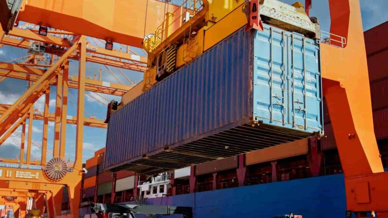
Argentina is a major agricultural exporter, and much of its overseas trade moves through a port network that extends beyond the Atlantic coast. Buenos Aires is a container gateway, while the Paraná and Uruguay rivers connect inland cargo with ocean routes. Let’s explore 30 selected ports in Argentina to see where they are, what they handle, and how they operate. What you learn may be a great help when planning a container shipment to Argentina.
Port of Buenos Aires (ARBUE)
Address: Cecilia Grierson 488, Puerto Madero, Ciudad Autónoma de Buenos Aires, C1107CPJ, Argentina.
Argentina’s federal container gateway links the Río de la Plata with international liner routes and the country’s largest metropolitan market.

- Annual TEU: 1,134,212 TEU (2025).
- Main functions: Container handling, general cargo, and passenger services within the wider federal port jurisdiction.
- Main cities served: Buenos Aires, Greater Buenos Aires, and inland distribution centres reached by road and rail.
- Published liner connections: China, Brazil, and Uruguay appear on rotations; another service links Northern Europe.
- Port congestion: Berth windows, truck arrivals, and access-channel draft can affect vessel and cargo timing.
- Puerto Nuevo scale: The official cargo-port description lists 23 berths and approximately 7,250 metres of quay.
- Port boundary: Puerto Nuevo handles commercial cargo; the redeveloped Puerto Madero waterfront is a separate area.
- Public port management: Agencia Nacional de Puertos y Navegación (ANPYN).
Port of Dock Sud (ARDSU)
Address: Av. Ingeniero Huergo 1539, Dock Sud, Avellaneda, Buenos Aires 1870, Argentina.
Dock Sud combines a large container terminal with an extensive fuel and chemical port complex south of Buenos Aires.
- Annual TEU: 956,077 TEU (2025, Exolgan terminal).
- Main imports: Fuels, metal goods, and industrial cargo recorded in the 2025 non-container dataset.
- Main exports: Fuels and industrial cargo recorded in the 2025 non-container dataset.
- Main functions: Containers at Exolgan; separate liquid-bulk and chemical berths within the port complex.
- Main cities served: Avellaneda, Buenos Aires, and the surrounding metropolitan industrial area.
- Berth distinction: Container and tanker facilities have different depths, equipment, and operating procedures.
- River access: Vessel draft depends on the assigned berth and current Río de la Plata navigation conditions.
- Public port management: Consorcio de Gestión del Puerto de Dock Sud.
Port of Rosario (ARROS)
Address: Av. Belgrano 341, Rosario, Santa Fe 2000, Argentina.
At Paraná River kilometre 420, Rosario connects a major agricultural and industrial region with river and ocean shipping.

- Annual TEU: 90,583 TEU (2025, Muelle ENAPRO reporting entity).
- Main imports: Fertilizers, metal goods, and minerals in the public-quay non-container records.
- Main exports: Grain, agricultural by-products, vegetable oils, and other farm cargo.
- Main functions: Public-quay containers, agricultural bulk, general cargo, and industrial logistics.
- Main cities served: Rosario, nearby Santa Fe industrial towns, and Córdoba’s inland market.
- Port congestion: Harvest traffic and river-level changes can affect truck arrival and vessel-loading plans.
- Berth depths: Official cargo-berth listings differ by section, from approximately 8 to 10 metres alongside.
- Public port management: Ente Administrador Puerto Rosario (ENAPRO).
Port of Ushuaia (ARUSH)
Address: Maipú 510, Ushuaia, Tierra del Fuego 9410, Argentina.
Ushuaia’s Beagle Channel position makes one waterfront serve island cargo, cruise vessels, and Antarctic logistics.
- Annual TEU: 34,728 TEU (2025).
- Main functions: General cargo, containers, cruise calls, and logistical support for Antarctic voyages.
- Main cities served: Ushuaia and other communities of Tierra del Fuego.
- Port congestion: Summer cruise and Antarctic schedules can intensify berth demand; wind and weather affect calls.
- Cruise season: More than 590 calls were confirmed for the 2026–27 season, adding pressure to a shared waterfront.
- Berth design: The official sheet lists 11–12 metres alongside, subject to current operational restrictions.
- Infrastructure status: Fender, fire-system, and berth works are part of the current federal intervention programme.
- Public port management: ANPYN manages operations during its 2026 administrative intervention.
Port of Puerto Madryn (ARPMY)
Address: Av. Rawson 0, Puerto Madryn, Chubut 9120, Argentina.
Puerto Madryn separates commercial cargo at Almirante Storni from cruise traffic at the central Piedra Buena pier.

- Annual TEU: 30,521 TEU (2025).
- Main imports: Chemical products and industrial goods in the 2025 non-container records.
- Main exports: Metal goods in the 2025 non-container records; fishery activity is recorded separately.
- Main functions: Containers, industrial cargo, fishing support, and cruise services at distinct piers.
- Main cities served: Puerto Madryn, Trelew, Rawson, and the wider Chubut coastal area.
- Country connection: A published Hapag-Lloyd Conosur service links Puerto Madryn with Brazil.
- Storni access: The commercial pier lies north of town and is reached by a long viaduct.
- 2025 fishing landings: 145,801 tonnes of catches, a fishery measure rather than cargo throughput.
- Public port management: Administración Portuaria de Puerto Madryn.
Port of La Plata (ARLPG)
Address: Ortiz de Rosas 151, Ensenada, Buenos Aires, Argentina.
The Ensenada–Berisso waterfront is closely tied to refining, chemicals, and access to the Buenos Aires provincial hinterland.

- Annual TEU: 27,701 TEU (2025).
- Main imports: Chemical products and oils in the 2025 non-container records.
- Main exports: Fuels and chemical products in the 2025 non-container records.
- Main functions: Liquid bulk, industrial cargo, and container handling.
- Main cities served: Ensenada, Berisso, La Plata, and neighbouring metropolitan markets.
- Access channel: A 13-kilometre channel is listed at 32 feet relative to local chart datum.
- Navigation constraint: The channel narrows inside the breakwaters, making berth and pilotage planning important.
- Public port management: Consorcio de Gestión del Puerto La Plata.
Port of Puerto Deseado (ARPUD)
Address: Zona Portuaria, Acceso al Puerto s/n, sobre calle España, Puerto Deseado, Santa Cruz 9050, Argentina.
Puerto Deseado combines Patagonian fishing landings with a merchant quay serving northern Santa Cruz.
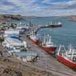
- Annual TEU: 11,420 TEU (2025).
- Main cargo: Fish and seafood landed by local fishing fleets.
- Main functions: Fishing-vessel landings, freezer operations, merchant cargo, and container handling.
- Main cities served: Puerto Deseado and northern Santa Cruz communities.
- 2025 fishing landings: 58,873 tonnes of catches, separate from TEU and total cargo tonnage.
- Quay scale: The official technical sheet describes 739 metres of berthing line.
- Port congestion: Fishing activity and planned berth repairs may tighten available working space.
- Public port management: Unidad Ejecutora Portuaria de Santa Cruz (UNEPOSC).
Port of Mar del Plata (ARMDQ)
Address: Calle B/P Marlin 404, Puerto Mar del Plata, Mar del Plata, Buenos Aires 7600, Argentina.
Fishing defines Mar del Plata’s daily rhythm, while repair yards, general cargo, and tourism broaden its role.
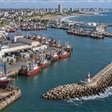
- Annual TEU: 7,251 TEU (2025).
- Main exports: Fishery cargo appears in the 2025 non-container export records.
- Main functions: Fishing, vessel repair, general cargo, tourism, and limited container traffic.
- Main cities served: Mar del Plata and nearby southeastern Buenos Aires Province communities.
- 2025 fishing landings: 401,057 tonnes of catches, Argentina’s largest reported port landing total that year.
- Port congestion: Fishing-season landings and truck movements can pressure quays and processing areas.
- Breakwaters: The south and north barriers protect the basin from Atlantic swell.
- Public port management: Consorcio Portuario Regional de Mar del Plata.
Port of Posadas (ARPSS)
Address: Calle del Puerto, Nemesio Parma, Posadas, Misiones 3300, Argentina.
Posadas gives Misiones exporters a container-barge option on the upper Paraná, far from Argentina’s ocean coast.
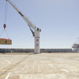
- Annual TEU: 2,534 TEU (2025).
- Main exports: Sawn timber, wood pulp, tea, and yerba mate.
- Main functions: River container handling, customs storage, and regional export consolidation.
- Main cities served: Posadas and other Misiones production centres, including Oberá and Eldorado.
- Documented export markets: The port authority names the United States, China, Portugal, and Italy.
- Industrial link: The port is near the Posadas industrial park, airport, and Paraguay crossing.
- River constraint: Upper Paraná water levels and barge schedules matter more than ocean-vessel draft.
- Public port management: Administración Portuaria de Posadas y Santa Ana (APPSA).
Port of San Antonio Este (ARSAE)
Address: Primero Pobladores 0, Puerto San Antonio Este, Río Negro 8521, Argentina.
This Río Negro export terminal is shaped by refrigerated fruit cargo and the timing of the harvest.

- Annual TEU: N/A.
- Main imports: Metal goods in the available 2025 non-container records.
- Main exports: Fruit and vegetables, including refrigerated cargo from Río Negro’s growing areas.
- Main functions: Reefer-container consolidation, temperature control, and general cargo handling.
- Main cities served: San Antonio Este, San Antonio Oeste, Viedma, and Río Negro fruit-growing districts.
- Port congestion: Fruit-export peaks and coastal weather can concentrate reefer and vessel activity.
- Cold-chain operator: Patagonia Norte operates the terminal’s refrigerated-fruit services.
- Public port management: Ente Regulador del Puerto San Antonio Este (ERPSAE).
Port of Bahía Blanca (ARBHI)
Address: Av. Dr. Mario M. Guido s/n, Ingeniero White, Bahía Blanca, Buenos Aires 8103, Argentina.
A long, deep access channel supports Bahía Blanca’s grain, chemical, fuel, and energy-related port terminals.
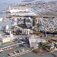
- Annual TEU: N/A.
- Main imports: Fertilizers, chemicals, industrial goods, and petroleum derivatives in the 2025 non-container records.
- Main exports: Grain, fuels, agricultural by-products, and chemicals.
- Main functions: Deep-draft bulk shipping, liquid cargo, industrial logistics, and general cargo.
- Main cities served: Bahía Blanca, Punta Alta, and Neuquén.
- Documented export destinations: China, Brazil, Saudi Arabia, Vietnam, and Malaysia appear in the 2025 port-authority table.
- Access channel: The port authority describes a 97-kilometre approach and maximum vessel draft of 45 feet.
- Port congestion: Grain-truck peaks, weather, and channel or berth restrictions can influence loading windows.
- Public port management: Consorcio de Gestión del Puerto de Bahía Blanca.
Port of Quequén (ARQQN)
Address: Juan de Garay 850, Quequén, Buenos Aires 7631, Argentina.
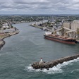
Deep water and an agricultural hinterland make Quequén a prominent Atlantic grain gateway rather than a container hub.
- Annual TEU: N/A.
- Main imports: Fertilizers in the 2025 non-container records.
- Main exports: Soybeans, barley, maize, wheat, vegetable oils, and agricultural by-products.
- Main functions: Ocean-going grain and bulk loading, with supporting storage and truck operations.
- Main cities served: Quequén, Necochea, Tres Arroyos, and Tandil.
- Documented export destinations: China, Vietnam, Saudi Arabia, Indonesia, and Brazil in the port authority’s report.
- 2025 cargo volume: 9.010 million tonnes handled across the authority’s stated whole-port boundary.
- Operating draft: The authority reports 50 feet after deepening and continued dredging.
- Port congestion: Atlantic weather windows and grain-truck peaks affected operations; 2025 operability was reported at 65%.
- Public port management: Consorcio de Gestión del Puerto de Quequén.
Port of Coronel Rosales (ARPRS)
Location: Muelle Puerto Rosales, Punta Alta, Buenos Aires, Argentina.
Puerto Rosales is an oil gateway within the Bahía Blanca estuary, with tanker movements defining its scale.

- Annual TEU: N/A.
- Main exports: Crude oil.
- Main functions: Petroleum storage, tanker loading, and links to Argentina’s inland energy network.
- Main cities served: Punta Alta, Bahía Blanca, and Neuquén.
- 2025 crude movements: 16.981 million tonnes and 259 ships in the port authority’s terminal report.
- Port identity: Its oil terminal is distinct from the estuary’s grain and general-cargo facilities.
- Operational focus: Tanker berth availability and crude-transfer schedules matter more here than container-yard capacity.
- Public port management: Consorcio de Gestión del Puerto de Coronel Rosales.
Port of San Nicolás (ARSNS)
Address: Av. Román Subiza at Ruta Nacional 188, San Nicolás de los Arroyos, Buenos Aires, Argentina.
An unusually large fertilizer-storage area gives this Paraná River public quay a clear agricultural supply-chain role.

- Annual TEU: N/A.
- Main imports: Fertilizers, minerals, metal goods, and fuels in the public-quay 2025 records.
- Main exports: Fertilizers, chemicals, metal goods, and oils in the same reporting boundary.
- Main functions: Fertilizer handling, bulk cargo, general cargo, and river-vessel operations.
- Main cities served: San Nicolás de los Arroyos, Ramallo, and Pergamino.
- Storage scale: The consortium describes approximately 870,000 tonnes of static solid-fertilizer storage capacity.
- Riverfront: The public port has about 750 metres of working frontage at Paraná kilometre 348.5.
- Port congestion: Fertilizer arrivals and river-depth limits can shape berth and inland-delivery planning.
- Public port management: Consorcio de Gestión del Puerto de San Nicolás.
Port of San Pedro (ARSNP)
Address: Ruta 191 Km 0, San Pedro, Buenos Aires 2930, Argentina.
San Pedro pairs an export-grain berth with a separate shorter berth for refrigerated and general cargo.
- Annual TEU: N/A.
- Main exports: Grain and other agricultural products recorded at the port in 2025.
- Main functions: Grain loading, general cargo, and refrigerated cargo handling.
- Main cities served: San Pedro, Baradero, and Pergamino.
- Berth layout: The grain berth is listed at 220 metres; the separate general-cargo berth is 75 metres.
- River position: The public port sits near Paraná kilometre 277, with sailing draft dependent on current water levels.
- Code note: ARSNP identifies the San Pedro locality in Buenos Aires Province, not an individual terminal.
- Public port management: Consorcio de Gestión del Puerto de San Pedro.
Port of Villa Constitución (ARVCN)
Address: Rivadavia 599, Villa Constitución, Santa Fe 2919, Argentina.
The public quay serves a Paraná industrial town, while the nearby Acindar steel terminal has a separate reporting boundary.

- Annual TEU: N/A.
- Main functions: Public commercial berthing and regional general-cargo activity.
- Main cities served: Villa Constitución, San Nicolás de los Arroyos, and Rosario.
- Public quay: ANPYN lists a 165-metre berth at Paraná kilometre 368.
- Alongside depth: The technical sheet lists 6.7 metres at the public quay, subject to river access conditions.
- Industrial distinction: Acindar’s private steel facility should not be counted as throughput at the public berth.
- Port congestion: River stage and limited public-quay space can affect loading plans.
- Public port management: Ente Administrador Puerto Villa Constitución (EAPVC).
Port of Santa Fe (ARSFN)
Address: Cabecera Dársena 1, Puerto Santa Fe, Santa Fe 3000, Argentina.
Santa Fe marks an important change in the Paraná system: waterway depth becomes more restrictive farther upstream.
- Annual TEU: N/A.
- Main functions: Barges, agricultural bulk, containers, and general cargo at separate berths.
- Main cities served: Santa Fe, Paraná, and Rafaela.
- River position: The port is near Paraná kilometre 584, at the upper end of the ocean-going section.
- Berth layout: The official sheet lists a 225-metre agro-bulk berth and a 270-metre container/general-cargo berth.
- Port congestion: A 15-foot nominal waterway section makes river depth a key constraint on loading and passage.
- Public port management: Ente Administrador Puerto de Santa Fe.
Port of Reconquista (ARRCQ)
Address: Calle Prefectura Naval s/n, Puerto Reconquista, Reconquista, Santa Fe 3560, Argentina.
Reconquista is a small upper-river port where barge and ferry access matter more than deep-sea cargo volume.

- Annual TEU: N/A.
- Main functions: Shallow-draft barge operations, local cargo, and river connections toward Goya.
- Main cities served: Reconquista, Avellaneda, and Goya.
- River position: The port lies by Riacho San Jerónimo near Paraná kilometre 950.
- Berth scale: One listed quay is 55 metres long with approximately 2 metres alongside depth.
- Navigation constraint: Low water and shallow approach conditions limit the vessels that can use the berth.
- Code note: ARRCQ is a locality code without a port-function flag in the consulted UNECE release.
- Public port management: Ente Administrador Puerto Reconquista.
Port of Concepción del Uruguay (ARCOU)
Address: Av. Paysandú 274, Concepción del Uruguay, Entre Ríos 3260, Argentina.
This Uruguay River gateway sends timber and other bulk cargo from Entre Ríos toward overseas markets.
- Annual TEU: N/A.
- Main exports: Wood products in the 2025 non-container records.
- Main functions: Ocean-going bulk berths, timber loading, and regional cargo services.
- Main cities served: Concepción del Uruguay, Colón, and Gualeguaychú.
- River position: The port is on the Uruguay River’s right bank near kilometre 154.
- Berth depths: Several bulk berths list about 7.62 metres alongside, separate from approach-channel limits.
- Port congestion: Water levels, channel maintenance, and timber-loading programmes influence sailing windows.
- Public port management: Ente Autárquico Puerto Concepción del Uruguay, coordinated provincially through IPPER.
Port of Ibicuy (ARIBY)
Address: Calle Pública s/n, Muelle Continental, Ibicuy, Entre Ríos 2823, Argentina.
Ibicuy’s public berth connects timber cargo from Entre Ríos with ocean-going vessels near the Paraná delta.

- Annual TEU: N/A.
- Main imports: Minerals in the available 2025 non-container records.
- Main exports: Wood products in the 2025 non-container records.
- Main functions: Timber loading, bulk operations, and ocean-going river-port services.
- Main cities served: Ibicuy, Ceibas, and Gualeguaychú.
- Berth design: The public Muelle Continental is listed at 220 metres and designed for Panamax-sized ships.
- Draft distinction: Its listed 12 metres alongside does not guarantee equivalent depth throughout the approach.
- Public port management: Ente Autárquico Puerto Ibicuy, with provincial IPPER coordination.
Port of Diamante (ARDME)
Address: Av. San Martín s/n, Diamante, Entre Ríos 3105, Argentina.
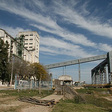
Diamante’s public quay and nearby private grain elevator must be read as two different reporting facilities.
- Annual TEU: N/A.
- Main functions: Public river berthing, regional cargo, and barge-scale logistics.
- Main cities served: Diamante, Paraná, and Crespo.
- River position: The provincial quay is near Paraná kilometre 533.6.
- Public berth: ANPYN lists 177 metres of frontage and approximately 7 metres alongside.
- Facility boundary: Cargill’s nearby grain elevator has a separate berth and separate cargo statistics.
- Port congestion: River depth and berth availability matter more than container-yard queues.
- Public port management: Ente Autárquico Puerto Diamante, with provincial IPPER coordination.
Port of La Paz–Márquez (ARLPA)
Address: Puerto 0, La Paz, Entre Ríos 3190, Argentina.
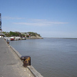
La Paz–Márquez is a small Paraná port whose berths serve different vessel types and very different depths.
- Annual TEU: N/A.
- Main functions: Productive barge cargo, local river traffic, tourism, and livestock-related movements.
- Main cities served: La Paz and Santa Elena.
- Berth contrast: A 100-metre productive berth lists 8 metres alongside; tourist/livestock frontage lists about 3 metres.
- Quay condition: The port authority has reported a sinkhole and repair work near Arroyo Cabayú Cuatiá.
- Port congestion: Current berth condition and Paraná water level should be checked before planning a call.
- Code note: ARLPA identifies the La Paz locality, without a port-function flag in the consulted UNECE release.
- Public port management: Ente Autárquico Puerto La Paz–Márquez, with provincial IPPER coordination.
Port of Rawson (ARRWO)
Address: Av. Marcelino González, frente al muelle, Puerto Rawson, Chubut, Argentina.
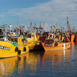
At the mouth of the Chubut River, Rawson’s small-vessel port is closely tied to the prawn season.
- Annual TEU: N/A.
- Main cargo: Prawns and other fishery landings, handled by the coastal fleet.
- Main functions: Fishing-vessel berthing, unloading, and local seafood logistics.
- Main cities served: Rawson and Trelew.
- 2025 fishing landings: 107,897 tonnes of catches, not container throughput or total port cargo.
- Port congestion: Prawn activity concentrates roughly from September to March, increasing pressure on unloading quays.
- Quay planning: A Murray Thomas quay extension has been studied; it should not be treated as existing capacity.
- Public port management: Chubut’s Dirección General de Puertos y Explotación Directa.
Port of Camarones
Location: Puerto Camarones waterfront, Camarones, Chubut, Argentina.
Camarones is a small fishing harbour whose scale differs sharply from Chubut’s larger commercial piers.
- Annual TEU: N/A.
- Main cargo: Fishery landings from small coastal and artisanal vessels.
- Main functions: Fishing berths, catch unloading, and local fleet services.
- Main city served: Camarones.
- Pier scale: A provincial study describes a quay approximately 40 metres long and 15 metres wide.
- Port congestion: Fishing arrivals and exposed coastal weather can affect a limited number of berths.
- Public port management: Chubut’s Dirección General de Puertos y Explotación Directa.
Port of Comodoro Rivadavia (ARCRD)
Address: Av. Las Toninas 387, Comodoro Rivadavia, Chubut 9000, Argentina.
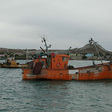
Comodoro Rivadavia serves the Golfo San Jorge energy and fishing economy through separate commercial and fishing quays.
- Annual TEU: N/A.
- Main functions: Ocean-going general cargo, fishing, vessel services, and support for the regional energy industry.
- Main cities served: Comodoro Rivadavia, Rada Tilly, and Sarmiento.
- Commercial quay: The official sheet lists 288 metres of frontage and about 10 metres alongside.
- Fishing quay: A separate 192-metre quay has a shallower listed depth of about 5 metres.
- Facility boundary: YPF’s General Mosconi pier and Caleta Córdova offshore loading are separate facilities.
- Port congestion: Wind, fishing activity, and commercial-berth allocation can change working windows.
- Public port management: Administración Portuaria del Puerto de Comodoro Rivadavia.
Port of Caleta Paula
Address: Zona Portuaria, Caleta Olivia, Santa Cruz 9011, Argentina.
Caleta Paula is an artificial harbour built for fishing and merchant vessels, with ship repair adding another role.

- Annual TEU: N/A.
- Main cargo: Fishery products and supplies for local marine operations.
- Main functions: Fishing, freezer-vessel services, merchant cargo, and shipyard activity.
- Main cities served: Caleta Olivia and Pico Truncado.
- Harbour design: The province describes approximately 10.5 metres of harbour depth and a 6.5-metre maximum tidal range.
- Quay scale: The national sheet lists 687 metres of total berthing line and 140 metres maximum ship length.
- Ship repair: The expanded yard resumed work in 2025, broadening the port’s marine-service role.
- Public port management: Unidad Ejecutora Portuaria de Santa Cruz (UNEPOSC).
Port of Punta Quilla (ARPQU)
Address: Zona Portuaria, Puerto Santa Cruz, Santa Cruz 9300, Argentina.
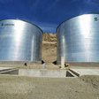
Punta Quilla’s two-sided pier and tidal channels make berth and approach choice especially important.
- Annual TEU: N/A.
- Main cargo: Fuel, general cargo, project loads, and some domestic grain movements.
- Main functions: Multipurpose berthing for merchant vessels, tugs, and fishing craft.
- Main cities served: Puerto Santa Cruz and Comandante Luis Piedrabuena.
- Berth geometry: The pier has two working faces for different vessel and cargo needs.
- Navigation: The southern approach suits deeper-draft vessels; the northern route serves smaller craft.
- Port status: Provincial authorities were pursuing national registration and navigation-aid restoration in November 2026.
- Public port management: Unidad Ejecutora Portuaria de Santa Cruz (UNEPOSC).
Port of San Julián
Location: San Julián Bay, Puerto San Julián, Santa Cruz 9310, Argentina.
San Julián’s sheltered bay is a provincial port location, but its present cargo status needs careful distinction.

- Annual TEU: N/A.
- Main city served: Puerto San Julián.
- Geographic setting: The waterfront sits inside San Julián Bay on Santa Cruz’s Atlantic coast.
- Navigation aids: The province identified balizamiento recovery as a necessary improvement in November 2026.
- Administrative status: National port-registration steps were still pending in the same provincial update.
- Code caution: ARSJL is a locality entry; its use as the port’s shipping code remains unverified.
- Public port management: Unidad Ejecutora Portuaria de Santa Cruz (UNEPOSC).
Port of Río Gallegos (ARRGL)
Location: Río Gallegos estuary, Río Gallegos, Santa Cruz 9400, Argentina.
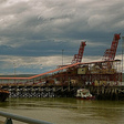
The provincial Río Gallegos harbour and Punta Loyola’s oil terminal are separate locations with different cargo boundaries.
- Annual TEU: N/A.
- Main city served: Río Gallegos.
- Main functions: Provincial public-harbour services on the Río Gallegos estuary.
- Estuary setting: Tides and local channel conditions are central to small-vessel access.
- Facility boundary: Punta Loyola’s Presidente Arturo Illia pier and oil movements must not be assigned to this harbour.
- Public port management: Unidad Ejecutora Portuaria de Santa Cruz (UNEPOSC).
Port of Barranqueras (ARBQS)
Address: Av. Almirante Brown s/n, Puerto de Barranqueras, Barranqueras, Chaco, Argentina.
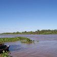
Far upriver from the Atlantic, Barranqueras links Chaco’s cargo with Paraguay–Paraná waterway transport.
- Annual TEU: N/A.
- Recorded imports: Products from Brazil and Paraguay in documented 2026 port activity.
- Recorded exports: Charcoal shipped to the United States, Norway, and Australia in individual 2026 operations.
- Main functions: River cargo, bonded storage, barge logistics, and regional trade handling.
- Main cities served: Barranqueras, Resistencia, and Corrientes.
- River position: The port is near Paraná kilometre 1202, well above the deep-draft lower-river reaches.
- Port congestion: Water levels and barge availability shape scheduling more than ocean-container berth queues.
- Public port management: Administración Portuaria Puerto Barranqueras (APPB).